
Services
List of Services
-
Australia Post - Piangil LPO
80 Murray St, Piangil Vic 3597
Ph: 03 5030 5403
-
Barry Knee Haulage
64 Mallee Hwy, Piangil Vic 3597
Ph: 03 5030 5670
-
Andrew Peace WinesList Item 3
4077 Murray Valley Hwy, Piangil Vic 3597
Ph: 03 5030 5291
-
Caltex PiangilList Item 2
82 Murray St, Piangil Vic 3597
Ph: 03 5030 5309
-
GraincorpList Item 1
19 Haywards Road, Piangil Vic 3597
Ph: 0427 855 569 / 0427 158 847
-
Piangil General Store
82 Murray St, Piangil Vic 3597
Ph: 03 5030 5309
-
Piangil Truck & Tractor
66 Murray St, Piangil Vic 3597
Ph: 03 5030 5461
-
Tapestries of the Heart
4 Mcgradie St, Piangil Vic 3597
Ph: 0409 511 985
-
Truck Wash Station
Piangil VIC 3597
Accommodation
Town Information and History
Piangil is a small rural township which is the terminus of the railway line 38 km north-west of Swan Hill, now only used for grain. The township and the river, which are 3 km apart, are separated by the Murray Valley Highway.
The name originated as the Piangil pastoral run, taken up in 1846 by William Coghill. It is thought that the name was derived from an Aboriginal word describing a fish (Murray cod).
Piangil was known as marginal Mallee grazing land when in 1894, 60sq km was reserved for a village settlement. Land was cleared which exposed it to wind erosion, and was a failure within a few years. During 1900-10 there was a push for limited irrigation of the lower river flats and irrigation blocks were released. The railway was extended from Swan Hill to Piangil in 1915.
Beyond the river flats there are elevated Mallee type soils which is used extensively for growing grapes, West of Piangil is a dry farming area, with wheat, sheep and fat lambs.
The population reached over 300 in the 1920s, and a school was opened in 1923. Additional facilities in the township include a hall, Catholic and Uniting churches, a general store and community hub. The school had 34 pupils in 1998, 18 in 2013 and 6 in 2014.
Drop into the cellar door of Andrew Peace Wines (Piangil), one of Australia’s largest family-owned wineries. BBQ and pizza oven available on request.
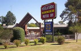
North-east of Piangil is the heritage listed Tooleybuc Bridge spaning the Murray River and built in 1925.
Nearby Towns
List of Services
-
Wood WoodList Item 3
Distance - 4km
Travel Time - 5mins
-
TooleybucList Item 4
Distance - 8km
Travel Time - 9mins
-
WoorinenList Item 2
Distance - 30km
Travel Time - 22mins
-
Swan HillList Item 1
Distance - 39km
Travel Time - 29mins
-
Managatang
Distance - 46km
Travel Time - 32mins
-
Boundary Bend
Distance - 51km
Travel Time - 35min